


| Home | Daily Reports | December | Day 247 |
| Day 247, Tuesday, 1 December, 2009 Distance travelled – 126.8 km Since leaving Perth we have encountered a number of international travellers who have expressed surprise at “how hilly Australia is”. They arrive believing Australia is flat and the international cyclists that we have met have had a nasty surprise by their discovery of undulating country in Western Australia. Combined with the head winds many of these cyclists are finding they may not have enough time to complete their journeys before they must return home. We came across a couple of separate cycling groups in Esperance either throwing luggage and clothing away or posting the majority of their luggage to Ceduna to reduce their loads whilst crossing the Nullarbor. In contrast there are Denise and I with our fully loaded bikes where our spare parts alone probably weigh more than the loads being carried by some of these international cyclists. With their limited water carrying abilities we wonder how such under prepared people are equipped to complete the journey from east to west.
So with the impression that the Nullarbor experience starts in Norseman we were a bit surprised ourselves when we found a sign 2 km west of Nullarbor Roadhouse that indicated that we were approaching the western end of the Nullarbor Plain. Had we not crossed that point somewhere in the last 5 days? The Nullarbor Roadhouse is indeed in the middle of a flat treeless expanse but as we discovered today less than 30 km east the flat changes to some very challenging hills. So in an attempt to dispel the myth of a flat crossing all the way across we thought we would publish the elevation profile for today. At the eastern end of the flat we did not find a complementary sign indicating the eastern end of the Nullarbor Plain so we are not sure if one exists or if it does, of its location. It would be interesting to know the Nullarbor Plain’s actual eastern and western boundaries.
Combined with the head winds today was a particularly difficult ride. Our original intent was to make Nundroo, however, shortly after 7.00pm we decided to call it a day, about 19km short. Zoom into the map and use the 'Satellite' layer to see our new location.
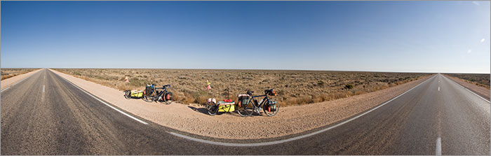
The "treeless plain" approx 10km east of Nullarbor Roadhouse. This 180 degree panorama shows the road west on the left and the road east on the right.
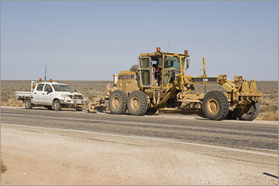
This grader was renovating the highway shoulder. Even with a head wind we were able to overtake it as it was moving so slow. It is towing the ute, so we assume at the end of the day the driver leaves the grader where it is and then drives home, where ever that may be.
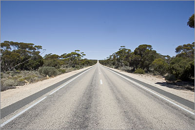
The not so flat road through the not so treeless plain.
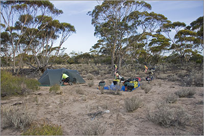
Bush Camp 091201 |
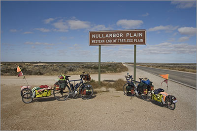 Even to Australians the Nullarbor Plain is seen as the flat treeless expanse between Norseman in Western Australia and Ceduna in South Australia. At the Visitor Centres in each of these towns you can get a certificate that indicates you have crossed the Nullarbor but the actual Nullarbor Plain only forms part of this crossing. To date the only truly flat country we have encountered has been between Madura and Eucla and the rest has been very undulating.
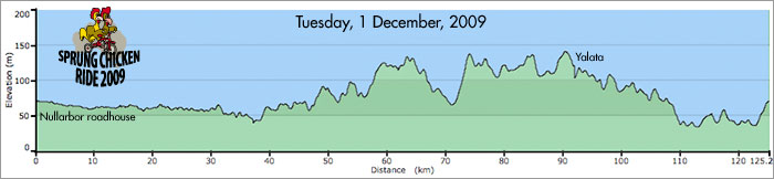
Home | Daily Reports | About | Contact Us | Merchandise | Site Map
© 2008 Mark Arundel