


| Home | Daily Reports | June | Day 069 |
|
Day 069, Saturday, 6 June 2009 Distance travelled – 121.2 km Bowen to Ayr We were woken at 3.00am by the town’s fire siren but were pleased to discover that unlike our trip through Adaminaby in April last year, there was nothing on fire near us. We left Ayr just before 9.00am. Our day started well. When we stopped for morning tea at Guthalungra about 35 km north of Bowen we both commented to each other that it did not feel like we had been off the road for more than a week. However, as the day progressed the wind changed and seemed to either be a head or side wind for the rest of the way. Over the last number of riding days shady places to stop for lunch or a break have been harder to find than further south. Although there have been trees along the highway the grass is extremely hard and long (1000mm or more) making it difficult to find a place out of the sun. Sometimes lunch corresponds with our arrival near a roadhouse or a small hamlet and today we ate in the shade of the mango trees out the front of Gumlu State School. The school’s name makes Gumlu sound like a big place but we suspect it only had 10 or so houses, if that.
The Burdekin River Bridge is an interesting looking structure and as we rode across and seemed to get no closer to its end we began to wonder how long it was. Later in the evening we would read that it’s 1.1 km long and took more than 10 years to build being completed in 1957. It is known as the ‘Silver Link’ and its name was taken by the caravan park we are staying at tonight, which has a model of the bridge over its gateway. Apparently it is the only bridge built in Australia built without a firm foothold with its footings built on more than 30 metres of sand. After all that we do not have any photos of either the bridge or the caravan park’s gateway, however, we do have ‘handle bar cam’ footage of both which we may publish when we have more time. After putting up the tent and having a shower two weary cyclists called the RSL club’s courtesy bus and went out for dinner. Zoom into the map and use the 'Satellite' layer to see our new location.
"Out House Take" south of Guthalungra (S19.96188 E147.94867 just in case you want to also 'go' there).
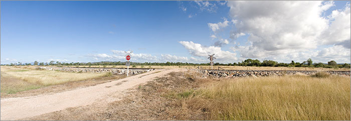
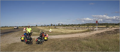
Another stop by the railway
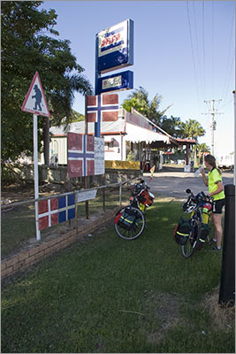
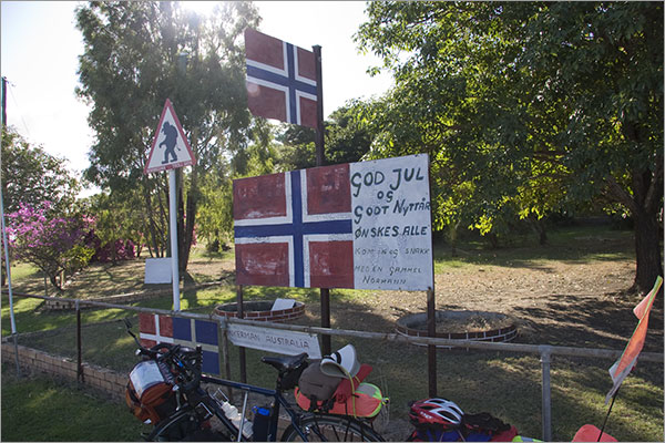
General store at Inkerman. Can anyone tell us why there is a Norwegian Troll sign here?
General store at Inkerman. What does this sign say? |
 We arrived at Home Hill about 4.00pm after an ice cream at Inkerman where we found ourselves underneath a Norwegian Troll warning sign. We are not sure about the reasons behind the sign. In the middle of Home Hill “CBD” there is the Comfort Stop a rest area designed specifically for caravans and motor homes, you are not allowed to pitch tents. There are free showers, toilets, barbecues and eating areas. The facilities looked very impressive but we could not see why you would like to park your caravan next to the railway line for the night, even if it is free.
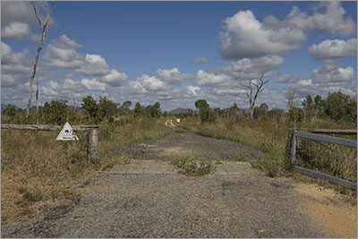
Home | Daily Reports | About | Contact Us | Merchandise | Site Map
© 2008 Mark Arundel