


| Home | Daily Reports | January | Day 298-300 |
|
Day 298, Thursday, 21 January, 2010 - Day 300, Saturday, 23 January, 2010 Stanley
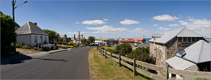
We have been to Stanley a couple of times in the past, (and I suspect Keri and I also rode here in 1978) but neither time have we stopped for a good look around. So this visit we have decided to stay at least 3 nights. Stanley is built on an ‘isthmus’ which is the name given to a narrow strip of land that joins two larger land areas. The town is not known for its isthmus, but for the large flat rock referred to as ‘The Nut’ that rises 150m between the town and sea. First sighted and named Circular Head by Matthew Flinders in 1798, ‘The Nut’ is the hard weathered plug left behind by a long extinct volcano. The history of the town dates back to 1825 when the Van Diemans Land Company was granted land at Circular Head to raise fine wool. Today Stanley is port to a small fishing fleet and is a popular tourist destination. Many of the buildings in the main street have links to the 1800’s and today house a mix of B&B’s, café’s and galleries. Zoom into the map and use the 'Satellite' layer to see our new location.
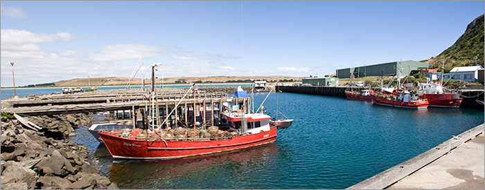
Stanley fishing harbour
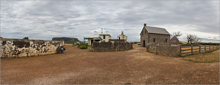
Highfield - "One of the most significant colonial farmsteads in Australia" - built by the Van Diemans Land Company in 1827. The Nut is in the background.
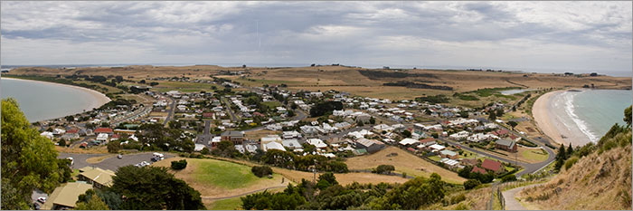
Stanley as seen from The Nut. Highfield is on the hill above the beach to the right.
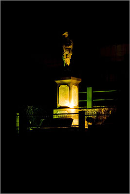
Stanley war memorial at night |
Home | Daily Reports | About | Contact Us | Merchandise | Site Map
© 2008 Mark Arundel