


| Home | Daily Reports | January | Day 302 |
|
Day 302, Monday, 25 January, 2010 Distance travelled – 76.2 km Wynyard to Waratah The first of what we know will be many days of climbing on our way to Hobart. We had hoped to show off the elevation profile for today as there are a number of steep climbs to 650m and decents to creeks and rivers before reaching Waratah. But our Garmin Edge failed to produce a downloadable history file. This has happened before and we do not understand why but we suspect it occurs when the ‘Lap’ button gets accidentally pressed. This is a feature designed for cyclists using the Edge as a training aid to record their progress on a circuit. We suspect if we rode past the point where the Lap button had been pressed the Edge would produce a history file that would allow us to create an elevation profile. Not knowing where the button was pressed means we would need to return to the begining and start the ride again. However, having climbed to Waratah, once is enough and we have no desire to turn around and go back again. Even with all the climbing it was a pleasant day and the scenery ever changing. Zoom into the map and use the 'Satellite' layer to see our new location.
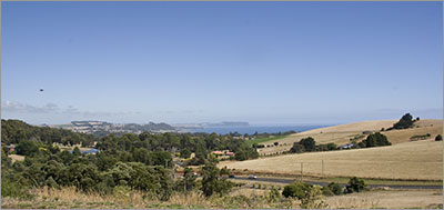
The view back to Wynyard and Table Cape
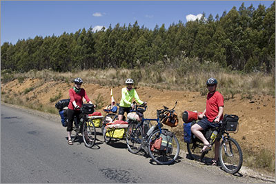
Robert and Ann from Germany at the end of their 5 week trip around Tasmania. They were riding down to the coast as we were riding up from the coast.
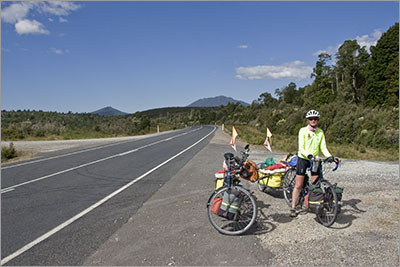
Rest stop. Cleared forest on the left of the road reveals the hills behind. |
Home | Daily Reports | About | Contact Us | Merchandise | Site Map
© 2008 Mark Arundel