


| Home | Daily Reports | March | Day 1 |
|
Day 003, Tuesday, 31 March 2009 Distance travelled – 32 km
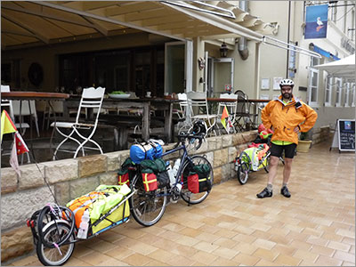
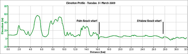
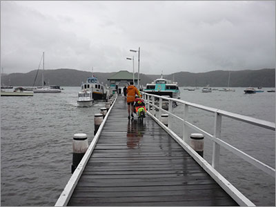
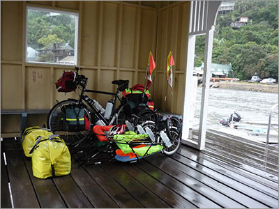
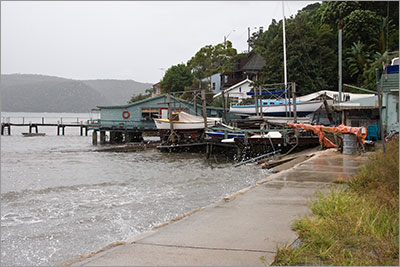
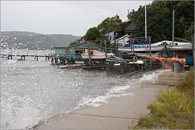
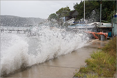
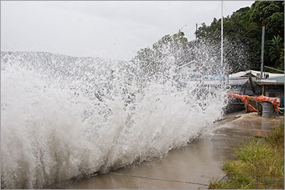
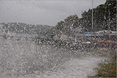
We left Sydney Lakeside Holiday Park at 10.45 am and headed for the ferry at Palm Beach which took us across the water to Ettalong Beach. This route was much more appealing than riding up the freeway from Hornsby to Gosford. Light rain was falling when we left Narrabeen and it continued sporadically until we neared Palm Beach when it became quite heavy. My [Denise] new Mont raincoat came in very handy, however, for most of our time on the road it was too warm to wear. Click this link to watch a video of what it was like on the road. The photo on the left was taken outside Barrenjoey House at Palm Beach where we sheltered from the rain. The ferry trip was quite spectacular in that the waves were high and many of the people on the ferry began to change colour. Luckily Mark and I felt fine. ABC news reported 6 - 8 metre waves off the Northern Beaches and the elevation profile from our GPS, below, confirmed the wave height as we crossed Broken Bay. The rough crossing definitely added to the experience. Click this link to watch a video of the crossing of Broken Bay. We arrived at the Ettalong Beach wharf, unloaded our bikes and rode the few kilometres to the Ocean Beach Holiday Park at Umina Beach where we had booked a cabin for the night. After we arrived, the rain became heavier and heavier - luckily for us we had not planned to camp. We spent the evening catching up with relatives who live at Ettalong. Zoom into the map to see our new location. Our icon is on top of the cabin that we stayed in.
Taking the bikes out to the Palm Beach Ferry
Bikes ready to load. The following five pictures are a sequence taken whilst waiting for the ferry. Some of you will be pleased to hear I got wet feet taking them.
|
Home | Daily Reports | About | Contact Us | Merchandise | Site Map
© 2008 Mark Arundel