


| Home | Daily Reports | November | Day 244 |
| Day 244, Saturday, 28 November, 2009 Distance travelled – 101.5 km
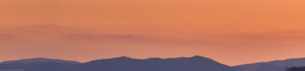
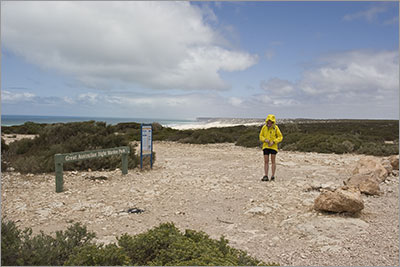
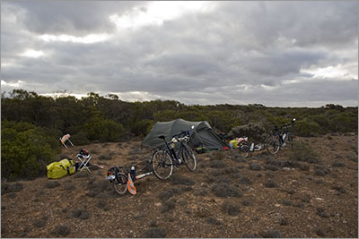
We have been looking forward to the ride today and tomorrow as the road goes close to the cliff tops that form the Great Australian Bight. In 2003 we drove this way and were lucky enough to see whales swimming at the bottom of the cliffs. This is the wrong time of the year to see whales but we were looking forward to the good views. Disappointingly two of the lookouts we had used in 2003 are now closed for safety reasons as the cliffs are being undermined by the sea. Although not as strong as yesterday the wind at the remaining lookouts kept us well away from the unfenced edge so we could not see as much as we saw in 2003. Even so the cliffs look spectacular. It would be great to be able to see them from the sea and the air. Perhaps this is an idea for another trip. Since crossing the border the sealed shoulder that we have grown to expect in Western Australia has disappeared and the carriageway itself seems to be a lot narrower. We especially notice this when being passed by the road trains. The shoulder is very loose deep gravel so when a vehicle is approaching from behind and we think we should ‘bail out’ we have to exit onto the shoulder early and be stopped well before the vehicle passes. The only good thing about a vehicle passing us from behind is that the draft it creates gives us a little boost but if it comes too close we will get blown into the gravel. A fast late exit will undoubtedly hurt so we are constantly monitoring our mirrors to see what is happening behind. When a road train is approaching from the front our technique is to wave to the driver and then grab the handlebars securely, put our heads down and brace for the buffeting. Having said all this the road is not that busy and because it is very straight we have lots of time to decide what to do. We found a good sheltered camp spot just after the ‘98k peg’. So far the Eyre Highway has been marked every 1km from the border by a numbered peg. As we slowed towards the end of the day these pegs began to emphasise how slow we were going as it seemed to take longer and longer to reach the next one. The evening was extremely icy and for the first time, whilst we set up camp, cooked and ate dinner, we both wore beanies along with long trousers and heavy jumpers. What a contrast to two weeks ago when this area was recording temperatures in the mid 40’s. Zoom into the map and use the 'Satellite' layer to see our new location.
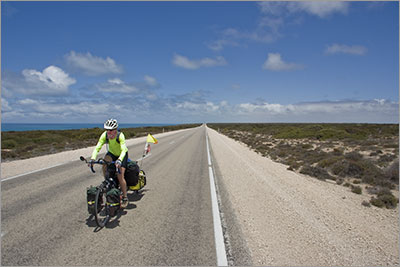
Scenic Lookout 13km east of Border Vilage
Scenic Lookout 13km east of Border Vilage. It was a cold day so we seemed to be always putting on our rain coats for warmth when we stopped.
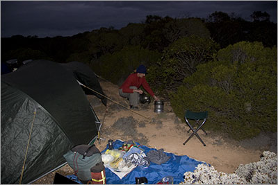
Denise alias 'The Bandit'
Bush Camp 091128
Denise cooking dinner and sheltering from the wind. Notice the beanie, it was an icy evening which was in complete contrast to the very high temperatures experienced here 2 weeks ago. |
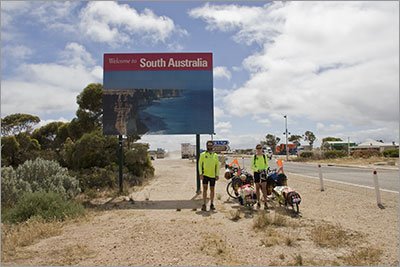 We had a late start this morning and began by returning to the border to take a photo of the ‘Welcome to South Australia’ sign. Yesterday evening when we came through the sun was reflecting on the sign so it did not photograph well. As we were wheeling our bikes along the wrong side of the road towards the sign a quarantine officer at the border checkpoint shouted at us as he thought we were trying to bypass the quarantine inspection into Western Australia.
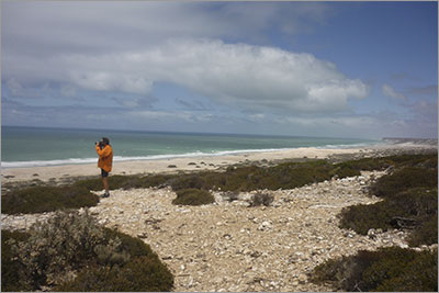
Home | Daily Reports | About | Contact Us | Merchandise | Site Map
© 2008 Mark Arundel